
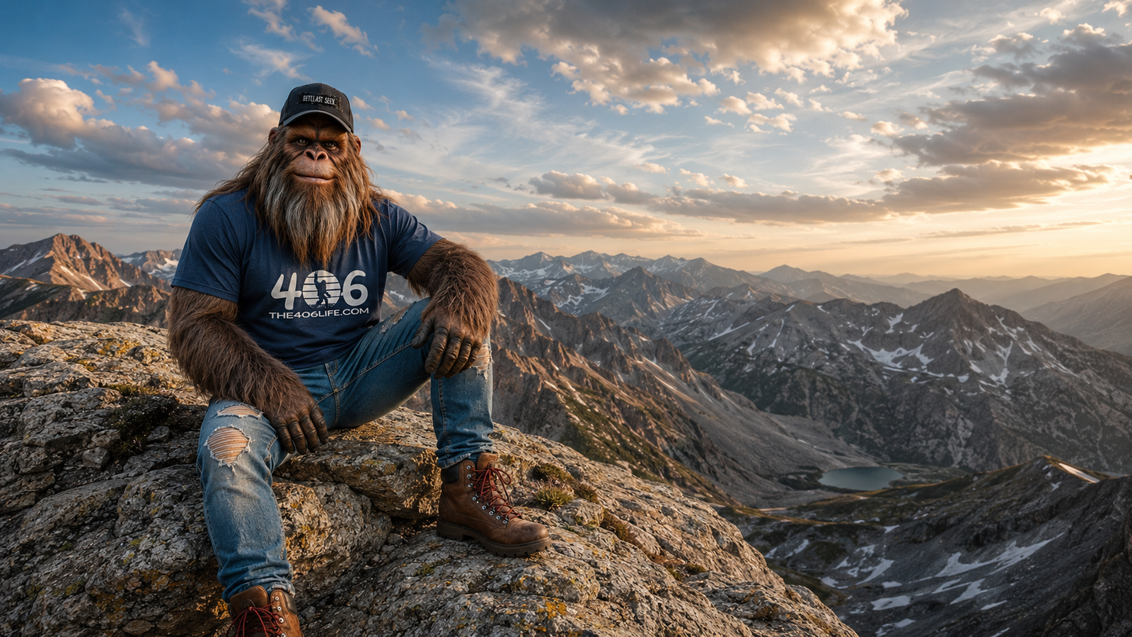
By Montana Max, resident Bigfoot, backcountry observer and the only Montana historian who has ever been mistaken for both a bear and a badly maintained shag rug
Montana does not do mountains halfway.
We don’t have one polite row of peaks standing shoulder to shoulder like they showed up for a school picture. We have mountains shoved over other mountains. Mountains made from rock nearly as old as Earth itself. Mountains that rose in the middle of the prairie like somebody pushed them up from underneath. We even have a pile of boulders that will play music if you hit the right ones with a hammer.
And that is before we get to the mountain where one raindrop can start toward the Pacific while another one lands a few feet away and begins a journey in an entirely different direction.
Most people look at Montana’s skyline and see scenery. Pretty scenery, certainly. The kind that makes tourists pull onto the shoulder without checking whether a logging truck is behind them.
But those ridges are not just scenery. They are evidence.
They record ancient seas, continental collisions, molten rock, glaciers, mining booms, sacred traditions, wildlife experiments and land decisions that are still affecting Montanans today. Our mountains are less like a postcard and more like a very old, very complicated family history—beautiful from a distance, dramatic up close and full of arguments about property.
So lace up your boots, bring water and keep your hands off anything sacred, protected or clearly on somebody else’s land. I’m Montana Max, and today we are taking the long way through the mountains.
First, Montana Is Not One Giant Mountain Chain
The western half of Montana is packed with the ranges most people picture when they hear “Rocky Mountains”: the Bitterroots, Cabinets, Missions, Swans, Flatheads, Lewis Range, Livingstons and many more. Farther south and east are the Beartooths, Absarokas, Madisons, Gallatins, Tobacco Roots, Gravellys, Pioneers and other ranges that developed from different combinations of uplift, faulting, magma and erosion.
Then central and eastern Montana pull a trick.
Out beyond the main wall of the Rockies, separate mountain groups rise from open prairie. These are commonly called island ranges because they look like dark, forested islands surrounded by an ocean of grass.
Even geologists and land managers do not all draw the family circle exactly the same way. A 2023 Montana Outdoors feature noted that commonly recognized island ranges include the Big Snowies, Judiths, North and South Moccasins, Highwoods, Little Rockies, Bear Paws and Sweet Grass Hills; some lists also include the Crazies and Little Belts. In other words, even the mountains have disputed membership rules. Very Montana.
The important point is this: Montana’s peaks did not all form at the same time or in the same way. Some were folded and shoved. Some rose as enormous blocks of ancient basement rock. Others were pushed upward when magma intruded beneath older sedimentary layers.
If you have ever tried to shove one more pair of wool socks into an already full drawer, you understand the basic concept of mountain building. Add tens of millions of years, crushing pressure and significantly more swearing.
Glacier’s Great Geological Shove
Glacier National Park looks carved, stacked and sharpened because it is the product of more than one enormous process.
Around 60 to 70 million years ago, movement along the Lewis Overthrust pushed ancient sedimentary rocks up and over much younger rocks. Later, glaciers carved the valleys, ridges and amphitheater-shaped basins that give the park its dramatic profile today. According to the National Park Service, some of the park’s smaller modern glaciers began forming roughly 7,000 years ago and continue shaping the alpine landscape.
That means when you stand along the Rocky Mountain Front and look at those layers, you are looking at older rock sitting on younger rock because the planet gave the normal order of things a shove.
Humans call that structural geology. Bigfoots call it “why you never assume the bottom box is the oldest one in the shed.”
Glacier also contains one of North America’s strangest pieces of plumbing: Triple Divide Peak.
The mountain sits where three major drainage systems meet. Water flowing from different sides of the peak can ultimately travel toward the Pacific through the Columbia system, toward the Gulf of Mexico through the Missouri and Mississippi, or toward Hudson Bay through Canadian waterways. The National Park Service describes those routes as leading toward three different oceans.
Think about that for a moment. A storm rolls over one Montana peak. Drops land only a short distance apart, then begin trips across an entire continent toward different seas.
I once tried to explain this to an elk. He stared at me, chewed for a while and walked off toward whichever watershed had fewer people. Hard to argue with that level of practical geography.
The Beartooths Contain Rock Almost as Old as Earth
If Glacier tells a story of rock being shoved and carved, the Beartooths tell a story so old it makes dinosaurs look like late arrivals.
Granite Peak, Montana’s highest point, rises to 12,799 feet in the Beartooth Mountains. The summit gets plenty of attention, but the truly shocking number is buried in the stone.
In 2025, the U.S. Geological Survey reported that zircon crystals found in part of the Beartooths have been dated to as much as 3.96 billion years old. Earth itself is about 4.54 billion years old. Those tiny crystals were already ancient beyond comprehension before Montana had forests, bison, roads, ranches or anybody selling a three-million-dollar “rustic” cabin with imported barnwood.
The Beartooths expose blocks of crystalline rock that spent immense spans of time buried, altered and moved before uplift carried them toward the surface. More recent glaciations—still ancient by human standards—then carved the plateaus and valleys recognizable today.
This is one reason Montana geology can scramble your sense of time. A human life feels long while you are living it. A century feels historic. A million years seems impossible. Then the Beartooths casually produce a crystal nearly four billion years old and make our entire species look like it arrived five minutes ago asking for the Wi-Fi password.
The Boulder Field That Rings Like Metal
About 18 miles east of Butte, near Pipestone, sits one of Montana’s finest examples of geology refusing to behave normally.
The Ringing Rocks look, at first, like a huge jumble of dark boulders. Strike the right rock lightly with a hammer or metal tool, however, and it can answer with a clear, bell-like tone.
Yes, the rocks ring.
No, there is not a tiny underground orchestra.
Probably.
The Bureau of Land Management protects the site and confirms the basic phenomenon. The more interesting question is why it happens, and that answer needs a little humility. A Montana Tech geologist interviewed by Montana Public Radio described a widely accepted hypothesis with two important parts.
First, the boulders are made of unusually dense crystalline rock formed when thick magmas mixed and cooled roughly 75 to 80 million years ago. Sound waves can travel efficiently through that dense material. Second, the rocks are stacked with open spaces between them, allowing them to resonate somewhat like the hollow body of a drum or guitar. Individual stones removed from the pile may still make sound, but the tone is weaker.
Here is the responsible-science part: researchers have a strong explanation, but no one has proved every part of the phenomenon beyond doubt. The original source article treated the mechanism as settled. It is more accurate—and frankly more interesting—to say the boulder field is still holding onto part of its secret.
The road to the site is rough enough that the BLM recommends a high-clearance vehicle. That is government language for “your low-slung sedan may return with fewer parts than it brought.” Do not remove rocks from the protected area. Hit them lightly, enjoy Montana’s natural lithophone and leave the band where you found it.
As a Bigfoot, I appreciate an attraction where visitors are specifically encouraged to make noise. It gives me time to move to the next drainage.
Crystal Park: Where Regular People Can Dig for Treasure
High in the Pioneer Mountains, at about 7,800 feet, the Forest Service manages a 220-acre recreation site called Crystal Park. Quartz crystals are scattered through decomposed granite, and visitors are allowed to dig for them in designated areas using hand tools.
The crystals may be clear, cloudy, white, gray or purple. Gray specimens are commonly called smoky quartz, while purple quartz is amethyst. Some are tiny. Others reach several inches.
Their story begins roughly 72 million years ago, when the Pioneer Batholith intruded the region. As the granite cooled, heated water circulated through fractures carrying dissolved minerals. Quartz and other minerals precipitated in veins and cavities. Long periods of glaciation, weathering and erosion later broke down the surrounding granite and freed crystals into material people can dig through today.
That sounds like easy treasure hunting until you are kneeling in the dirt, convinced the next scoop will contain the amethyst that pays off your truck, while the kid digging six feet away finds three beautiful crystals and asks whether they are “good ones.”
Most Crystal Park finds are keepsakes rather than retirement plans. The experience is the real prize: a chance to hold a piece of Montana’s geologic history in your palm and immediately start planning where it will collect dust in your house.
Rules matter. Digging is limited, only hand tools are allowed, tunneling is prohibited and the site is seasonal. Conditions and closures can change, so check the Beaverhead-Deerlodge National Forest’s current information before making the drive.
The Crazies: An Island of Stone—and a Modern Access Tangle
The Crazy Mountains rise with almost theatrical suddenness above the Yellowstone and Shields valleys. Crazy Peak reaches roughly 11,200 feet, towering far above the surrounding country. The range’s jagged shape is the exposed result of magma that intruded underground, forming a complex network of igneous rock later revealed and sharpened by erosion and ice.
But the Crazies cannot be understood through geology alone.
The mountains are culturally and spiritually important to the Apsáalooke, or Crow, people. Indigenous relationships with Montana’s mountains reach far deeper than the written records of explorers, miners and homesteaders. Across the island ranges, pictographs, ceremonial sites and continuing traditions make one fact plain: these were never “empty” landscapes waiting for newcomers to discover them.
That history deserves more than a drive-by mention. A mountain can be a recreational destination to one person, a sacred place to another, wildlife habitat to a third and part of a family’s working landscape to someone else—all at the same time.
The Crazies also contain one of the West’s most complicated public-access stories. Nineteenth-century railroad land grants created a checkerboard of alternating public and private sections. On a map it can resemble a quilt designed by an accountant with a grudge. On the ground it has fueled decades of arguments about trails, easements and legal access.
In January 2025, the U.S. Forest Service approved a decision for the East Crazy Inspiration Divide land exchange, involving 3,855 acres of federal land and 6,110 acres of private land in the Crazy Mountains and Madison-area Inspiration Divide. The agency said the plan was intended to secure permanent public access and improve habitat protection, while critics and supporters continued debating what the exchange would mean for particular lands and historical routes.
The lesson for visitors is not exciting, but it is important: a public-looking mountain is not necessarily publicly accessible from wherever you happen to be standing. Check current maps. Confirm routes. Respect private property. A screenshot somebody posted in 2017 is not a legal easement.
And if a six-foot-something hairy fellow tells you a trail is closed, verify the sign—but maybe listen to him anyway.
Mountains That Rose Like Islands from the Prairie
The central Montana island ranges are among the state’s most underrated landscapes.
The Big Snowy Mountains, south of Lewistown, form a high uplifted dome of sedimentary rock. The Forest Service lists Greathouse Peak at 8,681 feet, nearly 4,000 feet above the surrounding prairie. The range’s east-west spine averages more than 8,000 feet and includes the Big Ice Cave near its western end.
The Judith Mountains, North and South Moccasins, Highwoods, Little Rockies, Bear Paws and Sweet Grass Hills each rise apart from the main Rocky Mountain wall. Many were shaped when magma pushed upward into or through older sedimentary rock. Erosion later stripped away softer layers and helped reveal the distinctive landforms we see now.
A common feature of several island ranges is the laccolith. Imagine thick magma forcing its way between layers underground, then pushing the layers above it upward into a dome. It is less like a volcano erupting from the top and more like a blister forming beneath the planet’s skin.
That image is not elegant, but you will remember it.
The Sweet Grass Hills, near the Canadian border, are a dramatic example of an igneous intrusion rising from open country. The BLM says they formed about 50 million years ago, rise nearly 3,000 feet above the prairie and receive roughly twice the annual precipitation of the surrounding plains. That added moisture supports a forested habitat island for elk, deer and even a few moose.
The hills also have deep spiritual and historical associations with several Tribal nations and have been determined eligible for the National Register of Historic Places. Their significance is not merely scenic or geological. Visitors should treat cultural sites as places, not props—and should leave artifacts, stone features and ceremonial areas undisturbed.
The Mountains Changed the Animals, Too
An island of forest surrounded by prairie does not only look isolated. For some wildlife, it is isolated.
Montana Fish, Wildlife & Parks has described how mountain goats historically occupied many western Montana ranges but apparently could not cross miles of predator-filled prairie to colonize central island ranges on their own. Beginning in the 1940s, wildlife crews captured goats and transplanted them into ranges including the Highwoods, Big Snowies and Crazies.
Some populations thrived. The Big Snowies population eventually failed, with low genetic diversity considered a likely reason.
That is a striking reminder that a mountain can contain ideal-looking habitat and still be ecologically disconnected. A rugged peak may appear permanent and self-contained, but the life on it depends on movement, genetics, water, climate and human decisions.
Fish tell another version of the story. Cold island-range streams once supported native cutthroat trout. Introduced rainbow, brook and brown trout later competed with or hybridized with native populations in many waters. Wild turkeys, meanwhile, were introduced to Montana and became successful in many island-range habitats.
Wildlife management is rarely as simple as “put animal here, nature handles the rest.” Nature has never read the brochure.
Gold, Ghost Towns and Water That Still Needs Treatment
The same geologic forces that built and mineralized parts of Montana’s mountain ranges also attracted miners.
Gold and silver discoveries produced camps and towns including Zortman in the Little Rockies, Kendall in the North Moccasins and Maiden in the Judiths. Yogo Gulch in the Little Belts became famous for its cornflower-blue sapphires. Some places boomed. Some emptied. Some left problems that did not disappear when the last saloon closed.
Old and modern mining in the Zortman-Landusky area left a particularly sobering legacy. Exposed sulfide-bearing rock can react with air and water to create acidic drainage that mobilizes metals. Contaminated water from the mine area has required long-term treatment to protect downstream waters connected to the Milk and Missouri river systems and the Fort Belknap Indian Reservation.
There is the shocking part of Montana’s mountain story that rarely makes the tourism ads: geological wealth can create jobs and fortunes, but the environmental bill may remain long after the company, workers and profits have moved on.
Ghost towns are picturesque. Acid mine drainage is not. Both belong to the same history.
A Mountain Can Be Public and Still Be Hard to Reach
Many island ranges contain large areas of federal or state land because steep, dry ground did not fit the agricultural goals of the homesteading era. That helped preserve public land in places where surrounding prairie became privately owned.
But ownership and access are not the same thing.
Public parcels may be surrounded by private property. Roads may be sparse. Historical routes may be disputed, abandoned or changed. Conditions can also shift because of wildfire, weather, seasonal restrictions or land exchanges.
Before heading out:
- Check the current land-management map, not just a recreation app.
- Confirm that the road or trail providing access is legally public.
- Watch for seasonal closures, fire restrictions and road conditions.
- Respect gates and private-property signs.
- Do not disturb cultural sites or remove protected material.
- Carry water, layers and navigation tools; island ranges can be remote even when they look close from the highway.
Montana distance is deceptive. A mountain may look like it is “right over there,” which is a unit of measurement meaning anywhere from 20 minutes to the remainder of your natural life.
The Mountains Are Not Background
Montana’s ranges shape where snow falls, where rivers begin, where wildlife finds refuge and where towns were built. They contain sacred places, mineral wealth, public land and private history. They influence arguments about access and conservation that are still unfolding.
They also hold spectacular oddities:
- Ancient rock in the Beartooths contains zircon nearly four billion years old.
- Water leaving Triple Divide Peak can head into three continental drainage systems.
- The Ringing Rocks can sound like bells, though their full acoustic secret is not completely settled.
- Crystal Park lets ordinary visitors dig quartz from weathered granite high in the Pioneers.
- Island ranges rise from the prairie and create cool, forested habitat surrounded by grassland.
- Mining decisions made generations ago still affect water treatment today.
The shocking truth is not that Montana has a lot of mountains. Everybody knows that.
It is that the mountains are not one story. They are hundreds of stories stacked, faulted, folded and eroded together. Some are billions of years old. Some began with magma. Some live in ceremony and oral tradition. Some remain tangled in courthouse records and survey lines. Some ring when struck. Some look close until you start walking.
So the next time you see a Montana ridge in the distance, do more than admire it. Ask what pushed it up. Ask what ice carved away. Ask whose homeland it is, what animals depend on it, what was taken from it and whether the public can still reach it.
The view gets better when you know what you are looking at.
And if you happen to see a large, handsome, suspiciously well-informed Bigfoot studying the skyline, there is no need to take a blurry photograph. Just nod politely and keep moving.
I’m working.
Sources and Further Exploring
- National Park Service: Mountains of Glacier National Park
- U.S. Geological Survey: The Beartooth Mountains and Stillwater Complex
- Bureau of Land Management: Ringing Rocks
- Montana Public Radio: What Makes Montana’s Ringing Rocks Ring?
- U.S. Forest Service: Crystal Park Picnic and Mineral Collection Area
- Montana Outdoors: Mountain Peaks in a Prairie Sea
- U.S. Forest Service: Big and Little Snowy Mountain Ranges
- Bureau of Land Management: Sweet Grass Hills
- U.S. Forest Service: East Crazy Inspiration Divide Land Exchange Decision
- Montana Bureau of Mines and Geology: Geology of Montana
Travel note: Road conditions, closures, fees, fire restrictions and legal access can change. Check the appropriate land-management agency before visiting any site mentioned in this article.
Leave a Reply
You must be logged in to post a comment.